Our Mission
Our mission is to provide quality interior scanning solutions for 2D floor plans to U.S. Federal, State, Local/County governments, and any other clients who require as-built floor plans.
About Us
Are you trying to quickly create an as built floor plan or map of a large interior space? It’s nearly impossible to do this manually using a measuring tape and pencil. Even the laser measuring device you picked up at the local hardware store won’t cut it. With those products, you’ve spent a lot of time and are still left with a paper drawing that isn’t that accurate.
There are other companies that provide technology to map large and small indoor spaces; however, they focus on such precision that their methods are very slow and thus, too expensive.
Instead, our current focus is to turn your real world space into a digital form using an indoor mobile mapping solution developed by Robotic Paradigm Systems. This system is only available to select partners like Mapterior. Our services are high quality, fast, and very affordable.
Applications
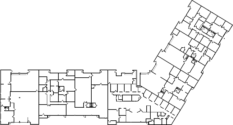
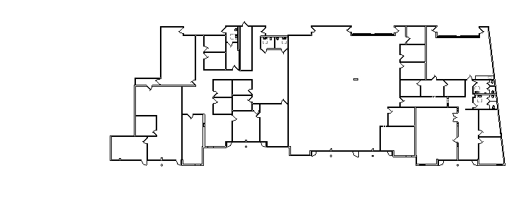
With dozens of individual rooms, office buildings can be time consuming to measure by hand. Our system allows us to map out complex spaces in the time it takes you to walk through the rooms, all without disturbing the workspace.
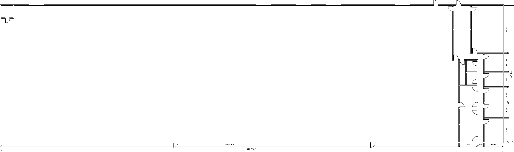
Warehouses
Large spaces can be difficult to measure by hand. Machinery or storage shelves on the floor can make it impossible to get accurate wall-to-wall measurements with a laser or tape measure. One walk through with Mapterior is all that is needed to get any measurement you might need.
Residential
Whether it’s individuals looking to build an addition or a real estate company keeping accurate records of their properties, Mapterior can provide quick results with friendly customer service. Faster results means fewer delays in construction or renovation jobs.
Square Footage Calculation
Almost all real estate sales are based on a building’s square footage. Unfortunately, many individuals or companies end up paying too much due to inaccurate or outdated plans and calculations. Mapterior has the capabilities to measure square footage at a competitive speed and accuracy.
Rentable Space
Just like real estate sales, leasing costs are based on square footage of the space. Many leasing offices do not obtain new as-builts when they purchase a building, instead using the original documents. These documents are usually inaccurate and based on old standards for square footage calculation. Updated floor plans and square footage calculation almost always increases the rentable area, therefore increasing profits.
Office Parks
Not only can Mapterior scan interior spaces, we can generate accurate outdoor measurements that would be difficult or impossible to obtain with hand measuring. This is especially useful for buildings with unusual shapes or multiple buildings on one site.
School Campuses
Schools of any kind are mostly made up of long hallways with many small classrooms that individually need to be dimensioned. Each room can be completely measured by walking in and out in a matter of seconds. This can reduce the overall on-site time exponentially.
Hospitals
There are many buildings that are occupied 24/7 and do not have the ability to evacuate everyone from the building. The less on-site time there is, the less an operator has to disturb staff and patients. With our current system, these disturbances are kept to a minimum.
Retail Spaces
Large retail stores, just like hospitals, have little to no downtime for technicians to take measurements. Retail stores have the added obstacle of shelves and merchandise that make it difficult or impossible to hand measure. Mapterior has the capability to navigate between shelving units and still get accurate wall-to-wall measurements.
Anything Else You Can Imagine
As-built floor plans are necessary for many different facets of modern life. With Mapterior, almost any building can be scanned, processed, and delivered without interrupting daily activities.
A list of important keywords and phrases used in the field and how they relate to our process.
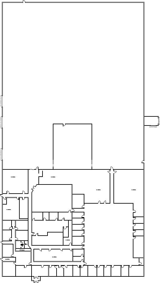
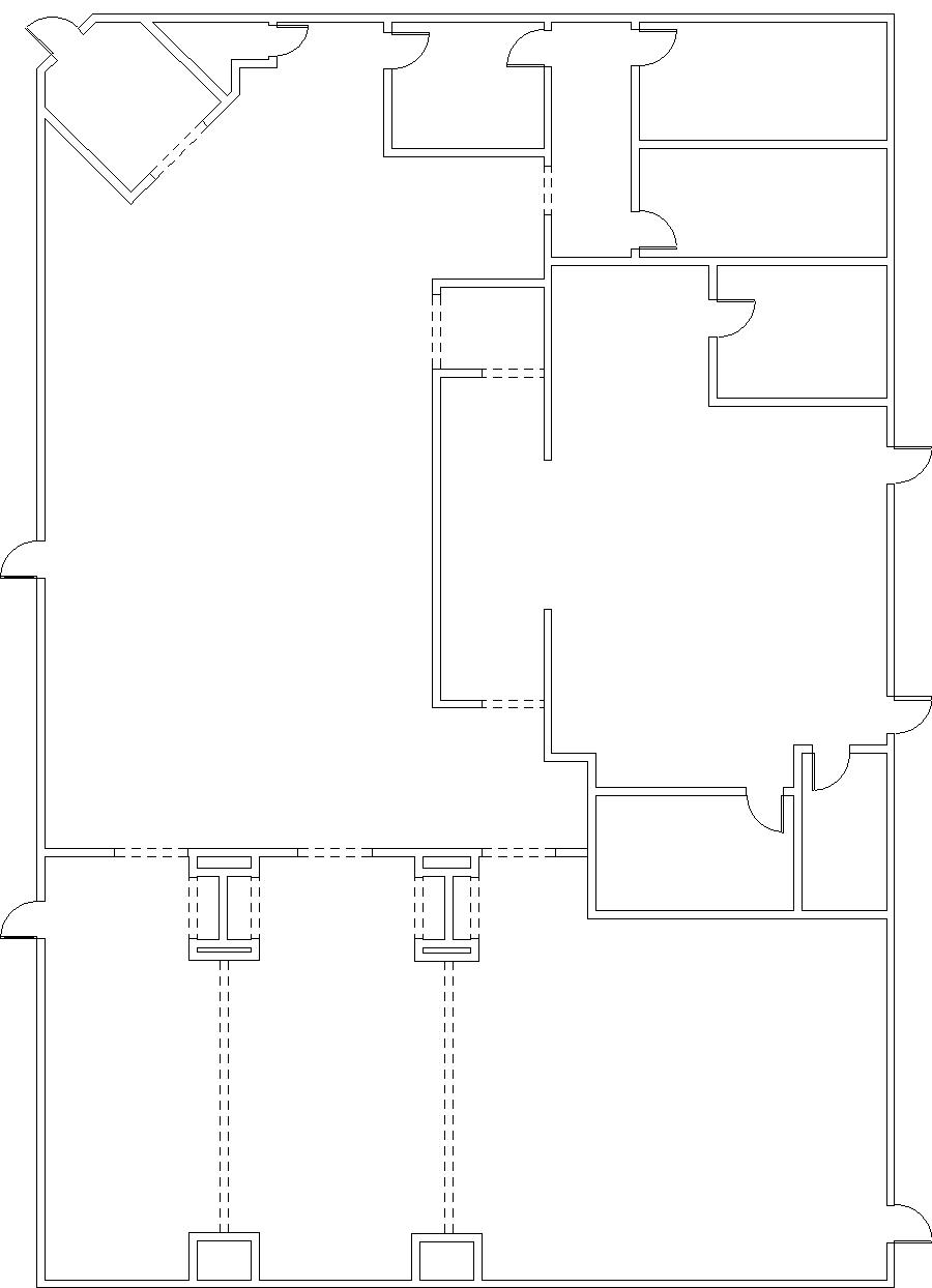
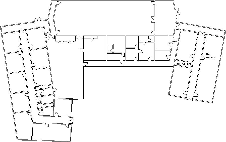
- Floor plan – a 2D diagram showing, from above, the relationship between rooms, walls, doors and other physical features at one level of a structure. This is the standard format for as-built drawings and the main output from RPScan.
- RPScan – The system developed by Robotic Paradigm Systems to generate as-built floor plans. Mapterior utilizes the unique process and technology to deliver results faster than our competitors.
- 3D Model – a three dimensional image of a building’s interior space showing floors, walls, doors, windows, and ceilings, along with a lot of other information that may not be understood from a floor plan. 3D models are also commonly used to help visualize what a space currently looks like or what the vision is for the future.
- Elevation View – a 2D diagram showing the vertical elements of a structure. Elevations are usually exterior views that show floor heights, wall materials and door and window placement.
- Section View – a 2D diagram that represents a vertical plane cutting through the building, similar to a floor plan. Sections are used to show the relationship of different levels and structural elements. Occasionally a sectional elevation view is used, which is a combination of section and elevation views.
- Layout – the relative position of walls, windows, doors, and other important building elements depicted in respect to 2D or 3D representation. Use this when you want to describe aspects of as-builts that are not specific to 2D or 3D.
- Interior Space – the structural layout of a building from the inside view. Is distinguished from exterior space because of the difference in lighting, volume, and data capture. Mapterior focuses on capturing features of interior spaces, but can also capture rough exterior measurements.
- Layout Artifact – the actual 2D or 3D representation of a layout. If it’s 2D then it can be the printed image or file. If it’s a 3D model then it could be printed representation or CAD model file.
The term As-Built is a common term used to refer to floor plans or drawings that represent the current or more up to date layout of a building. Due to recent or frequent changes to a building’s space and layout, old floor plans change and need to be updated. Almost any classification of building could benefit from accurate as-built floor plans.
One of the more important issues with out of date floor plan drawings is that there may be many stakeholders that know there are building changes but what and how much has changed is unclear. There are numerous uses for floor plan drawings. A lot of building management or construction projects depend on updated drawings such as Equipment installation, remodelling, space allocation and utilization. Incorrect or out of date drawings could result in waste of time or higher cost. Many building owners also do not have a copy of the original as-built floor plans, especially with older buildings.
Real estate is traditionally bought and sold based on square footage. This can vary over time with changes to the property or changes in calculation methods. Mapterior can help give real estate agents or property owners peace of mind that they are getting the most for their money.
Organizations or people who need updated interior layouts have used several approaches for accomplishing the different tasks in the process depending on how quickly, accurately, and what degree of detail is desired.
The goal is to create a floor plan or a 3D model. The latter requires more effort and is more complex to produce. The former represents less information but is easier to accomplish.
The first task is to capture all the measurements, which can be done with a tape measure or hand laser, or more sophisticated laser based device and then the measurements are used to create the drawings or 3D model. Hand measurements can be written down along with a sketch and later put into a CAD system or used to layout a floor plan from a hand-held tablet drawing tool.
More detail required results in more measurements being taken and more time spent creating the layout artifact. The use of sophisticated laser tools from Leica, Trimble, or Faro can make this process faster but they are more expensive, capture much more data than necessary and require feature rich but complicated software.
In any case, the generation of as-built layouts in the traditional fashion always seem to take longer than expected, require a lot more effort, and cost more than expected.
The most basic form of as-built floor plans only show walls and doors. Depending on the client’s needs, many other features can be included. Windows, plumbing fixtures, and furniture can be provided. A higher level of detail would require a higher amount of cost and time.
There are a number of companies in the business of providing architectural and construction documentation services, including architectural firms or construction contractors. There is no single business category or type that exclusively deals in developing as-build drawings, so finding the right company to provide floor plans or 3D models is difficult. In addition to hand laser or tape measure and notepad, companies with any one of the many sophisticated laser instruments can offer this service.
Q: Is Mapterior my competitor?
Mapterior employs a unique process for generating interior as-built layouts. The process is fast and accurate. Mapterior would rather team with an organization who provides as-built drawing services than compete. Mapterior is trying to position itself to do one thing very well-collect data and use a process that supports generating as-built floor plans very quickly and cost effectively. Jobs that were once too costly for other companies may be within Mapterior’s scope of work.
floor plans are drawings that represent placement of walls, doors and windows within an interior space. The degree of detail, such as bathroom fixtures, kitchen appliances, cabinets, closets and shelves, will vary. Floor plans typically depict a view of the interior layout from 4 feet above the floor and cut through anything at that level, showing sections of walls, doors and windows. Floor plans are often kept in hard-copy form or are 2D image that can be seen on a computer monitor.
3D Models of interior spaces capture aspects of the vertical dimension not found in floor plans and are typically viewed or manipulated using special CAD software. 3D models can vary in complexity depending on the detail provided by the CAD technician. Although 3D Models are more complex and require special software to view, they are in many ways more useful because many vertical aspects are more visible and easier to visualize.
The information required to create a floor plan vs a 3D model differs significantly, mainly because of the requirement to capture vertical dimensions as well. A 3D model can be used to generate many other drawings, such as a floor plan, elevation, section, etc.
Many times all that is needed is a floor plan, but often a floor plan is not enough and a 3D model is required for a project.
Traditionally, architectural drawings were made by hand with pencils, t-squares, and physical scales. With the advent of computers, all architectural documents moved from hand drawn to Computer Aided Design (CAD) programs.
Modern architectural documentation is almost exclusively generated on a computer and printed out on paper. The drawings in the computer are also called digital maps. Since they are still in the CAD software, these digital maps can be edited, measured and annotated to fit the customers needs.
Organizations should come to Mapterior when they find that other service providers’ bids are too high or take too long to complete.
Mapterior has a unique technology and process it uses to bring cost effective floor plans to the market. We can customize the process and results to accommodate the needs of many different clients.
Mapterior is pleased to offer a fast and less costly service to generate floor plans but there are situations that we may not be the best choice. Mapterior’s process does not provide millimeter accuracies like other companies who use more sophisticated tools. We are offering a lower but useful accuracy in exchange for speed, so our value really comes into play when projects involve a lot buildings and floors and less detail in the drawings are needed. We can support higher accuracies and add more drawing detail by extending our process. The added cost may still be well below other proposals.
Mapterior is a business that leverages its sister technology based company, Robotic Paradigm Systems, to provide cheaper and faster as-built drawing services. If you have a need you should approach us and tell us what you need. Our engineers and technicians know how to deal with challenges.
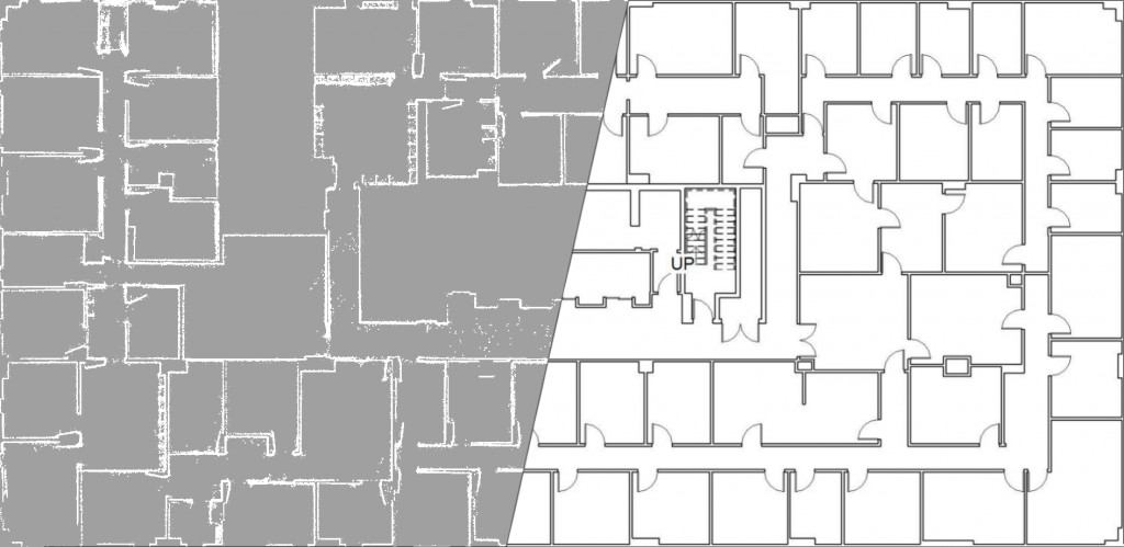
Facilities come in many shapes and sizes. Generating a layout for a warehouse is quite different from an office building. The first challenge we try to overcome is the site visit to collect data. Our goal is to collect all the information we need so that we do not have to return for follow up visits. One of our unique capabilities is to extract the measurements without interrupting daily activities. Since we use mobile technology to sense and collect spatial dimension data, we move very quickly through the interior space. Even areas with shelving units and cramped spaces are measurable for us. After returning back to the office, we take short time to post-processing the data into drawings. The start to finish time frame depends on the size, type of building, and requirements of the job. For example, a 15,000 sqft office space (approx 55 offices) with drawings showing only walls and doors could be delivered within 48hrs with time to spare.
It is very difficult to obtain hand measurements in large spaces without a clear line of sight between walls, small cramped spaces, and complex buildings with many rooms like office buildings.
By keeping track of where the operator is in relation to features nearby, RPScan can find the distance between two walls without being able to see both sides of the room at once. Small rooms can even be measured without fully entering the room. As long as the four corners of a rectangular room are captured, a full room can be generated. RPScan’s biggest advantage, speed, is compounded with large intricate buildings that would otherwise take days or even weeks to measure.
Mapterior has a unique process for developing as built floor plans. We use a laser based backpack system developed by Robotic Paradigm Systems to gather the raw data. Because of the mobility of the system, we can gather floor plans from spaces that would otherwise be difficult to measure. After a short post-fixing process, the data is brought into a CAD tool to generate the final deliverable drawings.
Pricing varies on size and type of building that is being scanned, so a rough estimate of area is useful. If necessary, Mapterior can estimate the square footage based on satellite images. This method is a last resort, however, as it is quite inaccurate.
Different types of buildings require varying amounts of work to scan. For example, a large open warehouse takes much less time to scan than an office building of the same footprint. Generally, the more complex the building the higher the cost per square foot will be.
Before starting to scan, Mapterior requires full access to the areas that need to be scanned. Any rooms that we cannot walk through will not be scanned.
Because of our non-invasive scanning method, we can measure rented spaces without interrupting daily activities. While they can continue normal daily operations, renters need to be made aware that we are coming for scanning. The scanning team also requires documentation from the owner giving permission to enter the rented spaces.
Address
Mapterior
504 Green Cove Road SE
Huntsville, AL 35803
Fax
(866) 684-6278
Email and Phone
Lynn Coddington Gilbert
lynn@mapterior.com
(678) 428-0935
Tim Coddington
tim@mapterior.com
(256) 694-3940